How to field survey highway paths
Scenario
One is out on the field and comes across a path that has not been mapped on OpenStreetMap. One chooses to create a survey field note.
At a later date, one processes the survey notes and realizes that one is having trouble georeferencing the details. Thus all the effort becomes useless in the betterment of OpenStreetMap.
Solution
With the utilization of the BFS field surveying heuristics1 one creates concrete reusable field notes.
BFS field surveying paths heuristic
The BFS field surveying paths heuristic is a schema for highway=path.
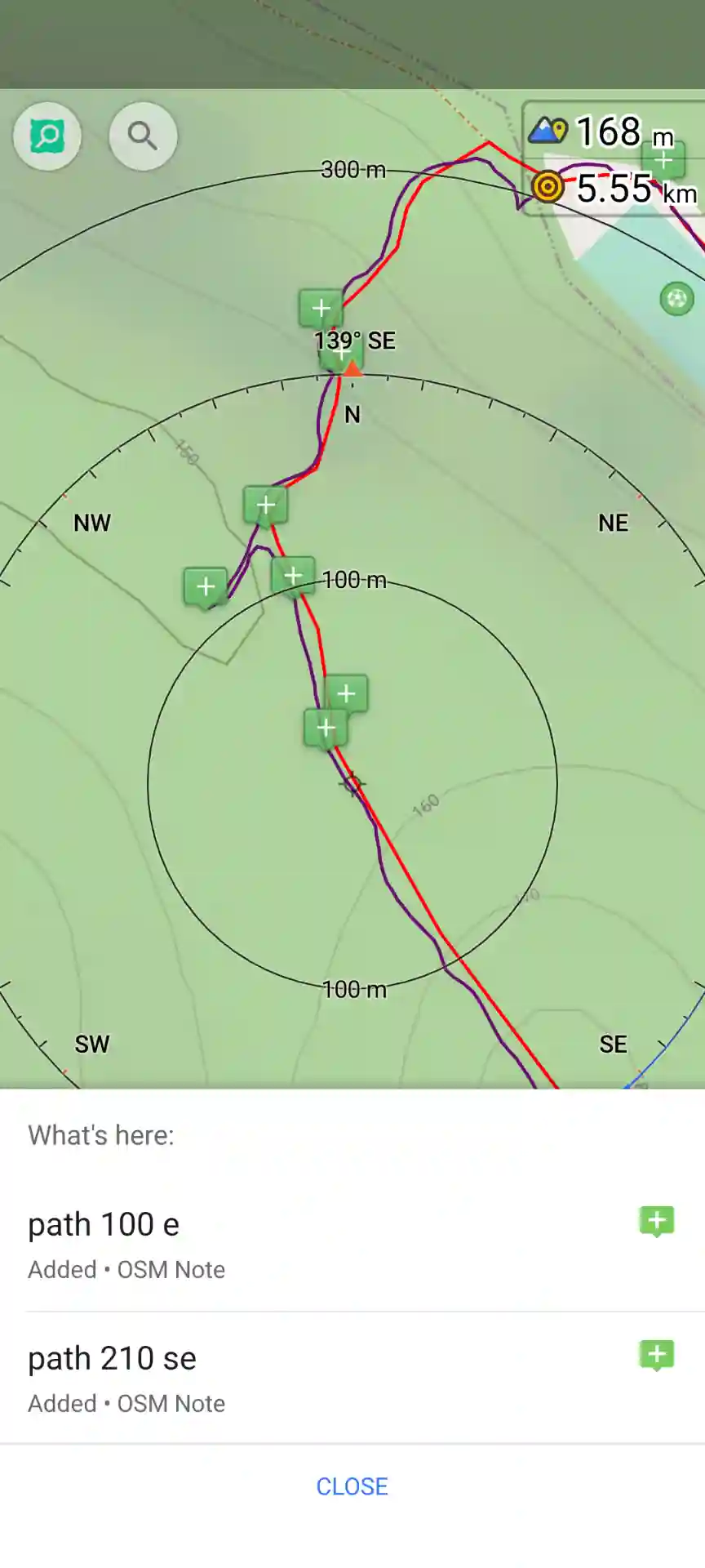
The field note utilizes the directionA value
1path <direction>
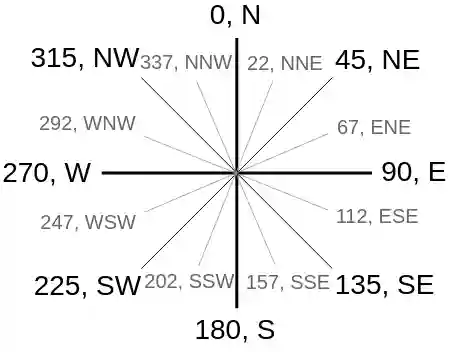
The value may be either a cardinal directionB (quick) or a degrees (slow) ranging from 0 to 359. (Image sourceC )
Additional keywords
both: the highway continues straight across the intersection with the current highway.stop:highway=stopexists at the head of the highway.yield:highway=give_wayexists at the head of the highway.- description of the path using characters like
J,T,C, etc.
Evaluation of the heuristic
- The direction removes the ambiguity that may come from not precise note placement while in the field.
- The direction removes remembering what right/left means when reflecting back on the moment.
- The direction is not dependent on the screen orientation aligning with north.
- Using cardinal directions quickly surveys the path without requiring the phone to be orientated towards the path.
- Using degrees takes more time to survey compared to cardinal direction and may ease post-processing.
- The convention using degrees is to round to the nearest 10 or 45 (meaning
NE=45°,SE=135°,SW=225°,NW=315°).
Post-processing
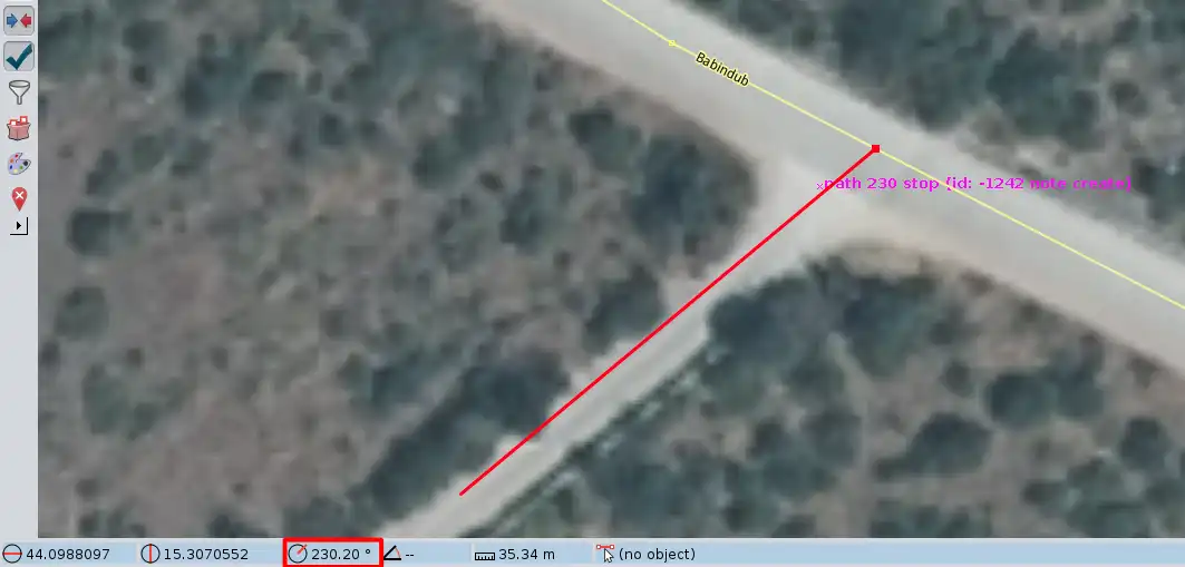
Post-processing within JOSM2 is simple since at the bottom of the app the angle information is presented. The way by default is highway=path unless additional information added in the note or can be deduced from aerial imagery.
NB fixme=* convention
- If only mapping a short distance, then add
fixme=continues?to give the potential to survey vel explore at a later date. - If estimating from aerial imagery, then add
fixme=gps?to share that the way has been estimated and more concrete measurements are required.
References
- OpenStreetMap key
direction=*, OpenStreetMap Wiki ↩︎ - Cardinal direction, Wikipedia ↩︎
- Compass with angles, OpenStreetMap Wiki ↩︎

-
BFS field surveying heuristics cookbook, BFS Source, ↩︎
-
JOSM editor, OpenStreetMap Wiki ↩︎